
Page 49 - Geography for Secondary Schools Student’s Book Form One
P. 49
Geography for Secondary Schools
Student’s Book Form One
was surrounded by a single superocean called Panthalassa. Over millions of years, the
geomorphic processes caused the Pangaea to break up into two big landmasses. The
northern landmass was called Laurasia, and the southern landmass was called Gondwana.
The two landmasses were separated by Tethys Sea. The two supercontinents broke into
present continents whereby Laurasia included present-day North America, Europe, and
Asia while Gondwana comprised of present-day Africa, South America, Antarctica and
FOR ONLINE READING ONLY
Australia.
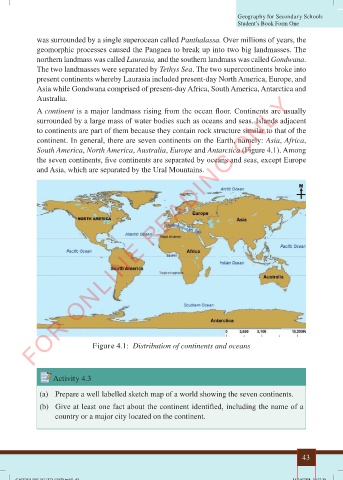
A continent is a major landmass rising from the ocean floor. Continents are usually
surrounded by a large mass of water bodies such as oceans and seas. Islands adjacent
to continents are part of them because they contain rock structure similar to that of the
continent. In general, there are seven continents on the Earth, namely: Asia, Africa,
South America, North America, Australia, Europe and Antarctica (Figure 4.1). Among
the seven continents, five continents are separated by oceans and seas, except Europe
and Asia, which are separated by the Ural Mountains.
Figure 4.1: Distribution of continents and oceans
Activity 4.3
(a) Prepare a well labelled sketch map of a world showing the seven continents.
(b) Give at least one fact about the continent identified, including the name of a
country or a major city located on the continent.
43
18/10/2024 18:32:39
GEOGRAPHY (F1) TO PRESS.indd 43
GEOGRAPHY (F1) TO PRESS.indd 43 18/10/2024 18:32:39