
Page 14 - Geography_n_Environment
P. 14
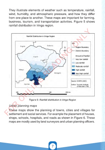
They illustrate elements of weather such as temperature, rainfall,
          wind, humidity, and atmospheric pressure, and how they differ
          from one place to another. These maps are important for farming,

          business, tourism, and transportation activities. Figure 5 shows
          rainfall distribution in Iringa region.
        FOR ONLINE READING ONLY


                             Figure 5: Rainfall distribution in Iringa Region

          Urban planning maps

          These maps show the planning of towns, cities and villages for
          settlement and social services. For example the placement of houses,
          shops, schools, hospitals, and roads as shown in Figure 6. These
          maps are mostly used by land surveyors and urban planning officers.


                                                  7


                                                                                          21/11/2024   16:57
   GEOGRAPHY AND THE ENVIRONMENT-STD 4.indd   7                                           21/11/2024   16:57
   GEOGRAPHY AND THE ENVIRONMENT-STD 4.indd   7