
Page 82 - Geography_n_Environment
P. 82
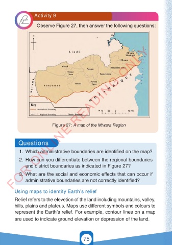
Activity 9


                           Observe Figure 27, then answer the following questions:


        FOR ONLINE READING ONLY


                               Figure 27: A map of the Mtwara Region


            Questions


            1.  Which administrative boundaries are identified on the map?
            2.  How can you differentiate between the regional boundaries

                and district boundaries as indicated in Figure 27?

            3.  What are the social and economic effects that can occur if
                administrative boundaries are not correctly identified?


          Using maps to identify Earth’s relief

          Relief refers to the elevetion of the land including mountains, valley,
          hills, plains and plateus. Maps use different symbols and colours to
          represent the Earth’s relief. For example, contour lines on a map

          are used to indicate ground elevation or depression of the land.


                                                 75


                                                                                          21/11/2024   16:59
   GEOGRAPHY AND THE ENVIRONMENT-STD 4.indd   75
   GEOGRAPHY AND THE ENVIRONMENT-STD 4.indd   75                                          21/11/2024   16:59